Page 4 - Nepal Destination Guide - Alluring Asia
P. 4
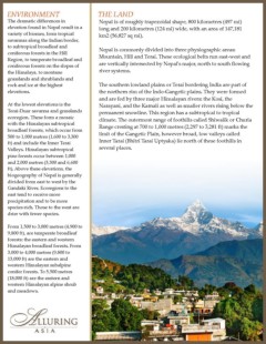
ENVIRONMENT THE LAND The dramatic differences in Nepal is of roughly trapezoidal shape, 800 kilometres (497 mi) elevation found in Nepal result in a long and 200 kilometres (124 mi) wide, with an area of 147,181 variety of biomes, from tropical km2 (56,827 sq mi). savannas along the Indian border, to subtropical broadleaf and Nepal is commonly divided into three physiographic areas: coniferous forests in the Hill Mountain, Hill and Terai. These ecological belts run east-west and Region, to temperate broadleaf and are vertically intersected by Nepal's major, north to south flowing POPULATION coniferous forests on the slopes of the Himalaya, to montane river systems. Approximately 28,670,677 (2011), grasslands and shrublands and growing from just 9 million in 1950. rock and ice at the highest The southern lowland plains or Terai bordering India are part of CLIMATE elevations. the northern rim of the Indo-Gangetic plains. They were formed Nepal has a typical monsoonal, two and are fed by three major Himalayan rivers: the Kosi, the season year. At the lowest elevations is the Narayani, and the Karnali as well as smaller rivers rising below the Dry Season: October - May Terai-Duar savanna and grasslands permanent snowline. This region has a subtropical to tropical Wet Season: June - September ecoregion. These form a mosaic climate. The outermost range of foothills called Shiwalik or Churia with the Himalayan subtropical CURRENCY Range cresting at 700 to 1,000 metres (2,297 to 3,281 ft) marks the broadleaf forests, which occur from The monetary unbit of Nepal is the limit of the Gangetic Plain, however broad, low valleys called 500 to 1,000 metres (1,600 to 3,300 Nepali ruppe (R's) which is divided Inner Tarai (Bhitri Tarai Uptyaka) lie north of these foothills in into 100 paisa (p) ft) and include the Inner Terai several places. Valleys. Himalayan subtropical TIME pine forests occur between 1,000 Nepal is five hours, 45 minutes ahead and 2,000 metres (3,300 and 6,600 of GMT. 30 Minutes ahead of Indian ft). Above these elevations, the Time. biogeography of Nepal is generally divided from east to west by the VISAS Gandaki River. Ecoregions to the Visas are required for Nepal. east tend to receive more precipitation and to be more species-rich. Those to the west are drier with fewer species. From 1,500 to 3,000 metres (4,900 to 9,800 ft), are temperate broadleaf forests: the eastern and western Himalayan broadleaf forests. From 3,000 to 4,000 metres (9,800 to 13,000 ft) are the eastern and western Himalayan subalpine conifer forests. To 5,500 metres (18,000 ft) are the eastern and western Himalayan alpine shrub and meadows.